Chester
An attempted field trip to a mine that turned into a nice hike.
The past weekend's weather report sounded rather dismal with showers and drizzle. Monday was to offer cooler temperatures, but some sun, so Monday was the day of choice.
The trip was to visit the site of old emery mine in Chester, Massachusetts. It was arranged through a club. With copy of required permit was in hand, I met up with three others. From our meeting point we paired up taking two vehicles to drive to the destination.
We expected to meet others two on arrival at the site. The entire site has several mines and dump areas. I had a good verbal description of where we would all meet. I also printed up directions too.
We arrived and followed a dirt road that became steeper and narrower as we progressed. It got to the point where my friend who was driving thought it would be unwise to drive further. The others had a truck that could handle the terrain better. They went further. There were a few trails off the roads, but we had no nothing seemed to match the description I was given.
We all back tracked to the one side street we passed on coming up this far. The side street was also a dirt road, but more navigable. There was a grassy area that we thought could be a mentioned parking area. We parked there and explored with no good results.
There was a home at the end of the side street, so we headed over there in hopes of getting information or directions. A woman there was very kind. She said that there are a couple trails that headed to the mine. She described one that we passed, but told us going up the hill where we first were would get us up to a trail that would be a shorter hike. She said it would also go near a pond. I could swear she also said that she had some mocha from the mine. I'm presuming she meant mica, and I envisioned her with a stunning piece of margarite or a fine mug of flavored coffee.
We all hopped into the truck and headed up to the described trail that started behind a house. We didn't have any trouble finding the trail. We all started. It was pretty much a continuous incline, to varying degrees, but nothing overwhelming.
The pond was now in view, below to out right. Gee, we hoped this was a good sign, but saw no evidence of any mine or dump areas still.
One in the group was an experienced tracker, another one hunts, so had knowledge of foot prints also. I would have walked by this muddy spot in the trail and not even think twice, but what could they point out to me? Moose tracks.
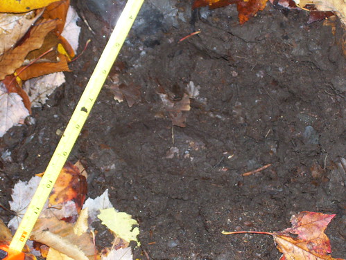
I guess we were safer seeing the tracks and not the moose, but it would have been exciting. Hell, I was exciting seeing the tracks.
Not far from there was a pile of bear droppings (this would have walked by and never even knew what it was). There must be quite a bit of wildlife out there.
We continued climbing upward until we reached the top. The view unfortunately was obscured. We decided to head back at that point. Never coming across any sign of a mining operation. The only souvenir that I brought back with me was a dark, coarse grained stone. I have no idea what it is yet.
We never saw the other two that planned to go. They did make it there and spent the day in the mine dumps. The problem was that I thought the printed directions were the same as the verbal ones that I was given. They were not. We were at most just a few miles from each other, but had no way to contact each other. The four of us who hiked together were only disappointed in not getting to the mine and dumps. We all enjoyed the hike and the beautiful day.
